SWISSVIEW - BE, Chasseral
Mountain | reviews | videos | photos
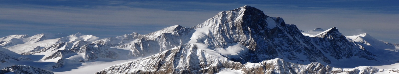
SWISSVIEW App for iPhone and iPad download now for free! SWISSVIEW App für iPhone und iPad jetzt gratis downloaden! http://www.swissview.com/app . http://www.swissview.com/blu-ray Der Chasseral ist ein 20 km langer Rücken nordwestlich des Bielersees (frz. Lac de Bienne) im Berner Jura, einem Teilgebiet des markanten Gebirgszuges nördlich des Alpenhauptkamms. Die Kette zieht sich von der Klus von Rondchâtel bei Péry (635 m ü. M.) bis zum Val de Ruz zwischen Neuchâtel (dt. Neuenburg, 479 m ü. M.) und La Chaux-de-Fonds (991 m ü. M.). Der Col du Chasseral (1'502 m ü. M.) verbindet in den schneefreien Monaten Saint-Imier (793 m ü. M.) mit Nods (885 m ü. M.). Der Sendeturm auf dem höchsten Punkt des Chasseral (1'607 m ü. M.) ist von weitem zu sehen. Von hier aus hat man bei optimalem Wetter Sicht auf den Mont Blanc (4'808 m ü. M.) in den französischen Westalpen und den Säntis (2'502 m ü. M.) in den Ostschweizer Voralpen. The Chasseral is a 20-km-long ridge northwest of Lake Biel-Bienne (French: Lac de Bienne, German: Bielersee) in the Bernese Jura, a section of the striking mountain range north of the main chain of the Alps. The mountain range runs from the Rondchâtel gorge near Péry (635 m above sea level) to the Val de Ruz between Neuchâtel (German: Neuenburg; 479 m above sea level) and La Chaux-de-Fonds (991 m above sea level). In the summer, the Col du Chasseral (1,502 m above sea level) connects Saint-Imier (793 m above sea level) with Nods (885 m above sea level). The highest point of the Chasseral lies at an altitude of 1,607 m above sea level and, with its transmitter tower, is visible from far away. In ideal visibility conditions, the Mont Blanc (4,808 m above sea level) in the French West Alps and also the Säntis in the Eastern Swiss pre-Alps (2,502 m above sea level) can be seen from the summit.
0m 0sLenght