Miami-Los Angeles flight: Downtown+Miami Beach, Mississippi River Delta, 29 Palms, Big Bear 2016-3-3
Mountain | reviews | videos | photos
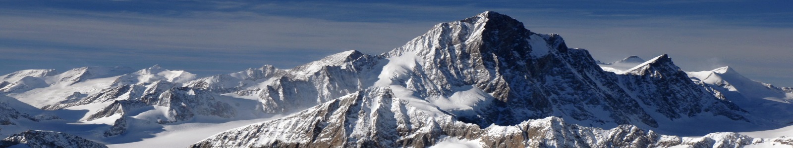
Miami's Marlins Park, Biscayne Bay, Miami Beach's condos and the intracoastal waterways rush into view on takeoff toward the Atlantic Ocean. On completion of the Gulf of Mexico crossing, the Mississippi's birdfoot mouth and the Cajun shoreline of Louisiana unfold. This is followed by Sabine Lake and the vast refinery urban complex of Port Arthur and Beaumont, and, farther inland, the Texas A&M University city of College Station, located in the midst of Texas's I-10/I-35/I-45 triangle--before the arrival of the oil rigs and the sand hills of central-west Texas. The arid mountains of Arizona follow, while alpine Big Bear Lake and the peaks of Southern California's Transverse Range to the northeast of Los Angeles, as well as the congested rush-hour freeways at dusk, accompany the descent and final approach to LAX. 1:55 Welcome message & start of pushback 2:55 Safety video begins 11:50 Takeoff run begins on MIA 8R 13:30-13:40 Marlins Park, Miami, Florida 13:45-13:55 Interstate 95 13:55-14:20 Downtown Miami 14:00-14:10 American Airlines Arena ("AAA"), Miami 14:20-14:25 MacArthur Causeway 14:25-14:30 Virginia Key & Key Biscayne 14:35-14:40 South Miami Beach ("SoBe") 16:15-17:00 North Miami Beach, Sunny Isles, Golden Beach, Hollywood Beach (see on-screen annotations) 17:20-17:35 Fort Lauderdale-Hollywood International Airport (FLL) 19:50 Start of Florida Everglades 41:20-41:59 Ship in Southwest Pass, Mississippi River Delta, Plaquemines Parish, Louisiana (LA) "Coastal Louisiana's land loss directly contributed to the storms' human toll. In the past, extensive healthy wetlands buffered South Louisiana from storm surge, but with thinning wetlands, oyster reefs and barrier islands, the area's communities have lost much of their natural protection." - More at: http://www.mississippiriverdelta.org/discover-the-delta/what-went-wrong/hurricanes-katrina-and-rita/#sthash.nRg89ogg.dpuf http://www.scientificamerican.com/article/mississippi-river-mouth-must-be-abandoned-to-save-new-orleans-from-next-hurricane-katrina/ http://www.theneworleansadvocate.com/news/13456037-128/experts-foresee-moving-mouth-of https://en.wikipedia.org/wiki/Mississippi_River_Delta http://www.mississippiriverdelta.org/discover-the-delta/how-the-delta-formed/ 44:45 Louisiana's Gulf of Mexico coastline near mouth of Mermentau River west of Grand Chenier, LA 46:05-46:48 Calcasieu Ship Channel/Cameron Ferry Cameron, Cameron Parish, Lake Charles, Louisiana http://www.usgulfcoaststatesgeotourism.com/content/calcasieu-ship-channelcameron-ferry/gul9A376660208ECE9F9 48:00-49:10 Sabine Lake LA & Texas (TX) 48:30-50:00 Port Arthur TX 50:00-50:05 Jack Brooks Regional Airport, Beaumont, TX 50:40-50:45 ExxonMobil Refinery, Beaumont, TX 50:47-51:05 Central Beaumont, TX 51:55-52:50 Trinity River east of Kenefick, Liberty County, TX 54:20-55:15 Interstate 69 near Splendora, Montgomery County, TX 55:40-56:05 Lake Conroe, TX 56:40-57:35 College Station TX 57:50-58:00 Taylor, Williamson County TX 58:10-58:35 Granger Lake (reservoir) San Gabriel River, TX 58:45-59:15 Texas State Highway 130 near Georgetown, TX 59:15-1:00:15 Interstate 35 north of Georgetown, TX 1:00:38-1:01:50 Lake Buchanan, Burnet & Llano counties, TX 1:02:40-1:02:55 Sandhill across Farm Rd 1233, northwest of Crane, Crane County, TX 1:03:20-1:03:55 Monahans Sandhills State Park, Interstate 20, Monahans, TX https://en.wikipedia.org/wiki/Monahans_Sandhills_State_Park 1:04:05-1:04:25 San Simon River (ephemereal) in San Simon Valley, southeastern Arizona (AZ) https://en.wikipedia.org/wiki/San_Simon_River_(Arizona) https://en.wikipedia.org/wiki/San_Simon_Valley 1:04:25-1:04:355 Peloncillo Mountains, Cochise County, AZ https://en.wikipedia.org/wiki/Peloncillo_Mountains_(Cochise_County) 1:06:15-1:06:23 Arizona State Route 266 https://en.wikipedia.org/wiki/Arizona_State_Route_266 "Sometimes, big things really do come in small packages. And big scenery often comes on little roads. State Route 266 is one of the shortest state highways in Arizona — with just under 20 miles of pavement cutting across the rugged rangeland south of Safford — but every mile dishes up dramatic vistas as the road rambles westward along the fringe of the Pinaleño Mountains ...." More at: https://www.arizonahighways.com/explore/scenic-drives/stockton-pass-road#sthash.DAqBvmk0.dpuf https://www.arizonahighways.com/explore/scenic-drives/stockton-pass-road 1:07:03-1:08:20 AA credit card offer 1:07:36-1:08:15 Mount Graham, Graham County, AZ & Mount Graham International Observatory https://en.wikipedia.org/wiki/Mount_Graham https://en.wikipedia.org/wiki/Mount_Graham_International_Observatory 1:09:31-1:10:00 La Paz County, AZ 1:10:06-1:10:44 Twentynine Palms, San Bernardino County, California (CA) https://en.wikipedia.org/wiki/Twentynine_Palms,_California Please see video annotations for additional locations 1:30:50 Touchdown on LAX 25L More on this flight: http://flightaware.com/live/flight/AAL2435/history/20160303/2030Z/KMIA/KLAX
Comments
-
I love all the descriptions of places you give.
-
"Very quick 5 hours". Give me a break. They always say that. On my flights to London they say "very quick 11 hours." Lol
-
Is it really that loud inside the plane? I can imagine trying to sleep like that, or do they offer you ear plugs
-
I like your vids, it's like being there
-
Last time I flew it was in 2007. One question , please. Do they let you now record the take off and landing ? I remember they always said that you are not allowed to.
-
Amazing info..!!!
-
Great video as usual and very detailed! It will help me plan my next flights and flight paths. :)
Was that Cap Canaveral at around 21 min?
Also and If you don't mind my asking, what camera model are you using?
I am usually taking photos when flying, but this seems like a better idea! -
were you ever on flight when people asked for the can of soda and the flight attendants said no.
-
By By JaiAlai! Trent 500 engines?
0m 0sLenght